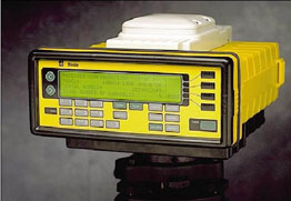

Trimble Receiver and Antenna
"Is there evil but on earth? or pain in every peopled sphere?"
-- Alfred, Lord Tennyson, Locksley Hall Sixty Years After
Equipment Used
All data was collected with a Trimble 4000 Site Surveyor SSI GPS receiver with an L1/L2 choke ring antenna, both shown below.
Trimble Receiver and Antenna
Repeatability of Position Fixes
The satellites of the GPS constellation have repeating ground tracks with a period of 12 sidereal hours. This means that every 12 sidereal hours, the satellites are in the same relative position with respect to any point on the earth. Since multipath is geometry dependent, this means that if everything remains the same at a receiver location, the multipath properties will repeat every 12 sidereal hours. So, position fixes computed from two sets of data collected at one location 12 sidereal hours apart should correspond (within the magnitude of the other errors, i.e., non repeatable multipath, ionosphere and troposphere errors, etc.) Before the experiment was conducted, a callibration test was performed using actual data, in order to determine the degree of repeatability of the position fixes.
Data Collection
GPS pseudorange data was collected from a location on the roof of the Center for Space Research (CSR) for 2 hours.
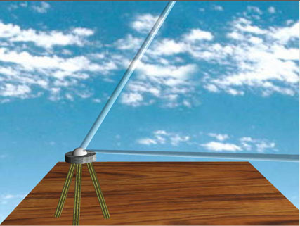
Data collection without sphere.
A beach ball of 4-ft diameter (1.2-m) was covered with aluminum foil. This served as the multipath producing sphere. 12 sidereal hours after the first data collection, at the same location, 2 more hours of data were collected. The first hour, without the sphere, the second hour with the sphere. The sphere was placed 3-m over and 1-m above the antenna. Since the antenna choke ring is specifically designed to minimize multipath that arrives from low elevations, the sphere had to be placed above the choke ring plane.
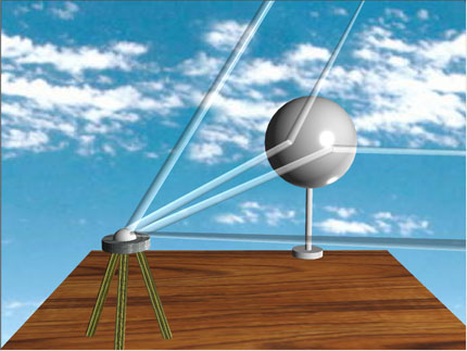
Data collection with sphere.
In addition, near the end of the data collection, the sphere was removed from its perch and carried around the antenna in a spiral pattern. A summary of the data collection is shown below.

In addition to the data collection, the survey receiver was used to obtain the true location of the antenna and sphere. This information is needed for the computation of the locations of the reflection points from each satellite.