A Closer Look at the Evolving Coast
Coastal communities face growing flood risks as land gradually sinks and sea levels rise. Understanding where and how quickly the ground is subsiding is essential to assessing those risks, but measuring changes of just a few millimeters per year remains a significant scientific challenge.
A recent study involving Ann Chen, associate professor in the Department of Aerospace Engineering and Engineering Mechanics at UT Austin, examined satellite-based measurements of land subsidence along the U.S. Gulf Coast. The researchers found significant differences between two published datasets, raising questions about how accurately current satellite techniques capture subtle ground movement in coastal regions covered by dense vegetation and wetlands.
New satellite technology could help close that gap. The NASA–Indian Space Research Organization Synthetic Aperture Radar (NISAR) mission, launched in July 2025, is expanding access to radar observations that can help scientists track changes across Earth’s surface. For Chen, these advances offer an opportunity to improve measurements of land motion and provide more reliable data for understanding coastal flood risks.
We spoke with Chen about why measuring land subsidence is so challenging, what her team’s findings reveal about current satellite methods and how new technology could help scientists better understand and prepare for changes along vulnerable coastlines.
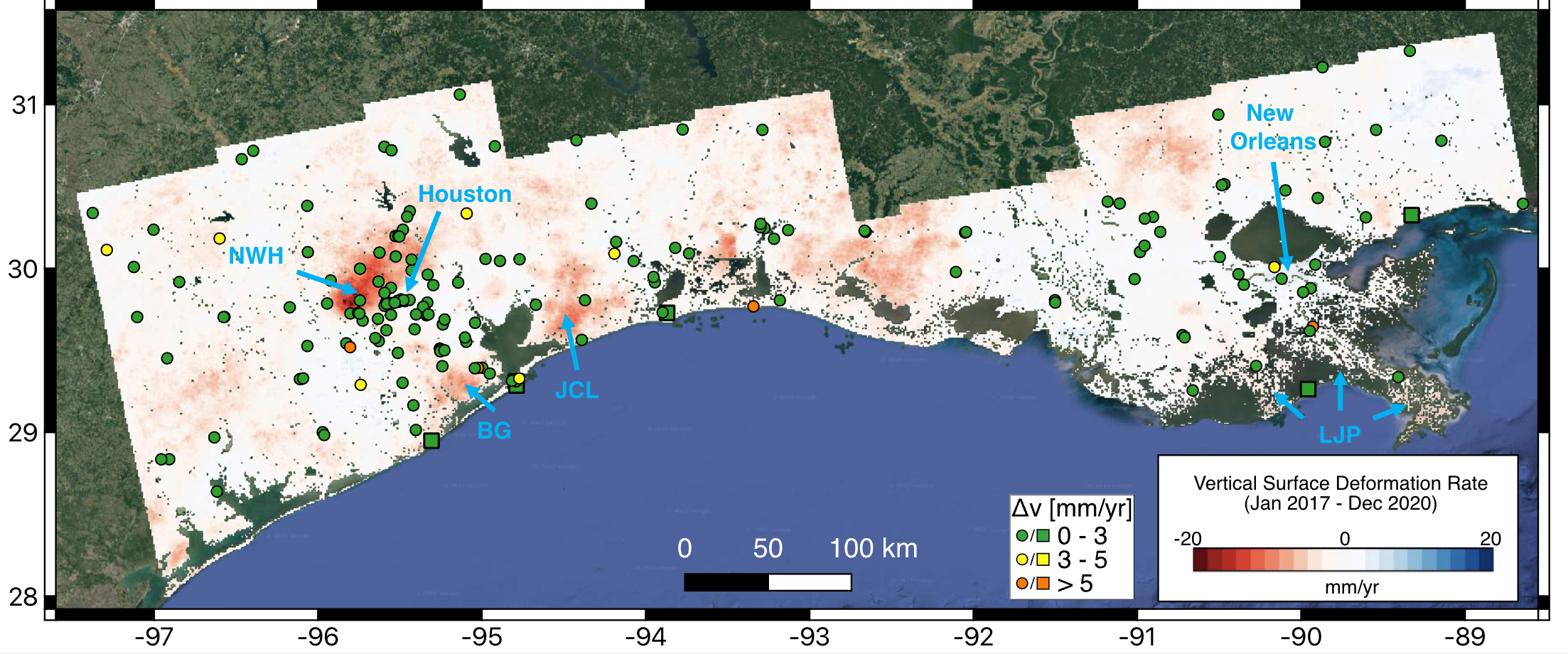
Your recent work entered a broader scientific debate about measuring coastal subsidence. What happened, and why does it matter?
Spaceborne Interferometric Synthetic Aperture Radar (InSAR) satellites can retrieve surface deformation history with up to millimeter-level accuracy at 10-100-meter spatial resolution. However, different assumptions or InSAR processing strategies can lead to different deformation solutions in regions with a low signal-to-noise ratio such as the densely vegetated Gulf Coast. We showed that two recent InSAR datasets (Ohenhen et al., 2024 and Wang et al, 2024) from the central U.S. Gulf Coast produce contradictory results, complicating efforts to gauge relative sea level rise in vulnerable areas.
What are GNSS and InSAR, and how do they help scientists measure a changing coastline?
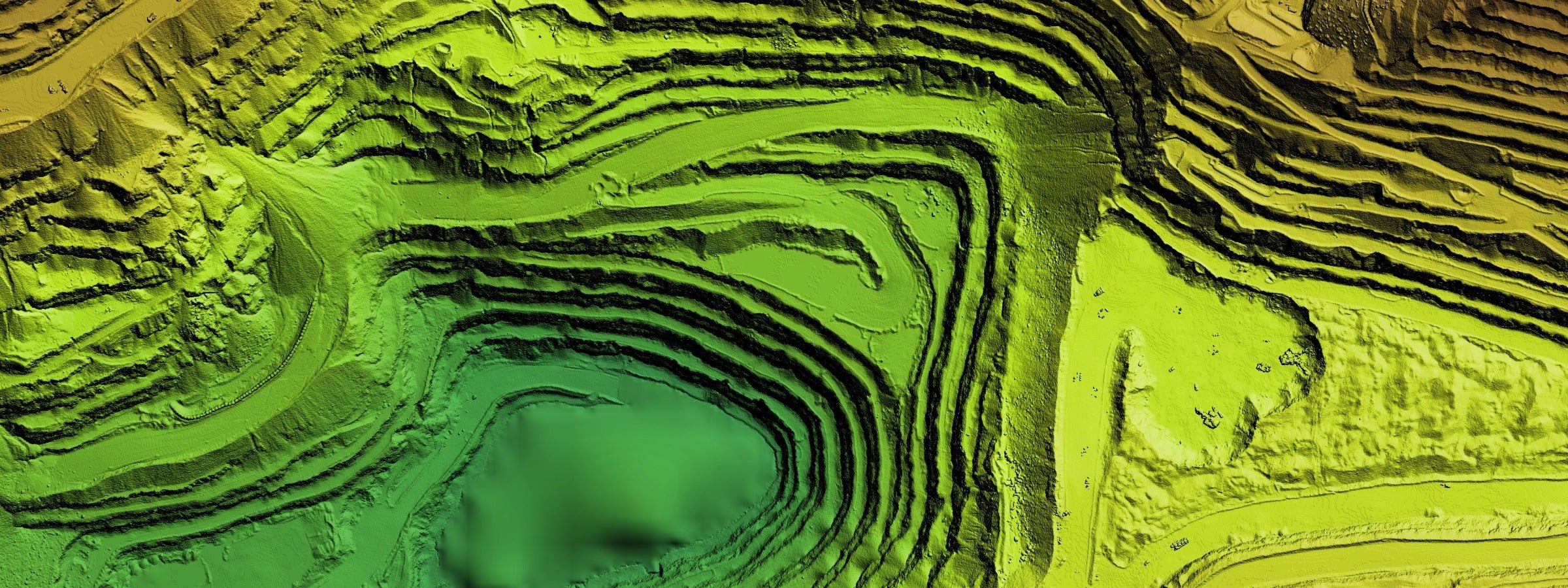
Permanent Global Navigation Satellite System (GNSS) stations can provide daily east, north, and vertical position solutions over a long period of time with millimeter-level or better accuracy. They are commonly installed at plate boundaries to monitor tectonic deformation. They are also installed on buildings, roads or dams for infrastructure monitoring. Interferometric Synthetic Aperture Radar (InSAR) computes the phase difference between two Synthetic Aperture Radar (SAR) images. The resulting interferogram can be used to infer a map of surface deformation between two SAR acquisition times along the radar line-of-sight direction. The benefits of InSAR are fine spatial resolution (10s-100s meters) and broad ground coverage.
Why is the Gulf Coast one of the most challenging places in the world to study land motion?
The spatial coverage of GNSS permanent stations outside the major urban centers is sparse. For example, the nearest GNSS stations are often more than 25 kilometers apart in less-populated regions on the Gulf Coast, which is not sufficient to capture the spatial variation of vertical land motion required for flood hazard assessment. It is also very difficult to map land subsidence along the Gulf Coast using InSAR. This is because (1) the expected deformation signals from many coastal processes are very small, only a few millimeters a year; and (2) large portions of the coastal landscape are covered by wetlands and dense vegetation. Vegetation growth between radar acquisitions can corrupt the subtle deformation signals we try to detect.
How can better measurements help communities prepare for flooding and sea-level rise?
A key question is how natural and anthropogenic subsidence processes modify compound-flood hazards across low-gradient coastal landscapes. Natural compaction of deltaic sediments produces widespread subsidence along the Gulf Coast, while hydrocarbon production and groundwater extraction can generate localized and spatially variable subsidence. This subsidence contributes to erosion, wetland and ecosystem loss, infrastructure damage, and increased flood exposure. This is why high-quality vertical land motion data are critical for improving flood-risk assessments and guiding investments in coastal protection and resilience strategies.
What excites you most about the future of satellite monitoring and coastal resilience research?
The recently launched Sentinel-1 and NISAR missions have provided nearly global InSAR coverage on a six-to-12-day repeat cycle. Along with the planned future InSAR missions (e.g., ROSE-L) and emerging commercial small satellite constellations, the quantity and quality of spaceborne radar data are expected to increase dramatically in the coming decade. This will allow us to capture subtle changes occurred at the Earth’s surface and interior that are currently undetectable. I’m excited to explore how these newly available InSAR data can inform social decisions at all levels concerning coastal resilience.